Coast

Devon is the only county in England with two coastlines.

Coastline near Bigbury, David Chamberlain

Dawlish Warren, South East Devon Wildlife

Braunton Burrows, Mary Breeds

Snapshot for coasts

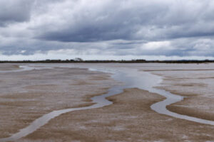
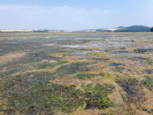
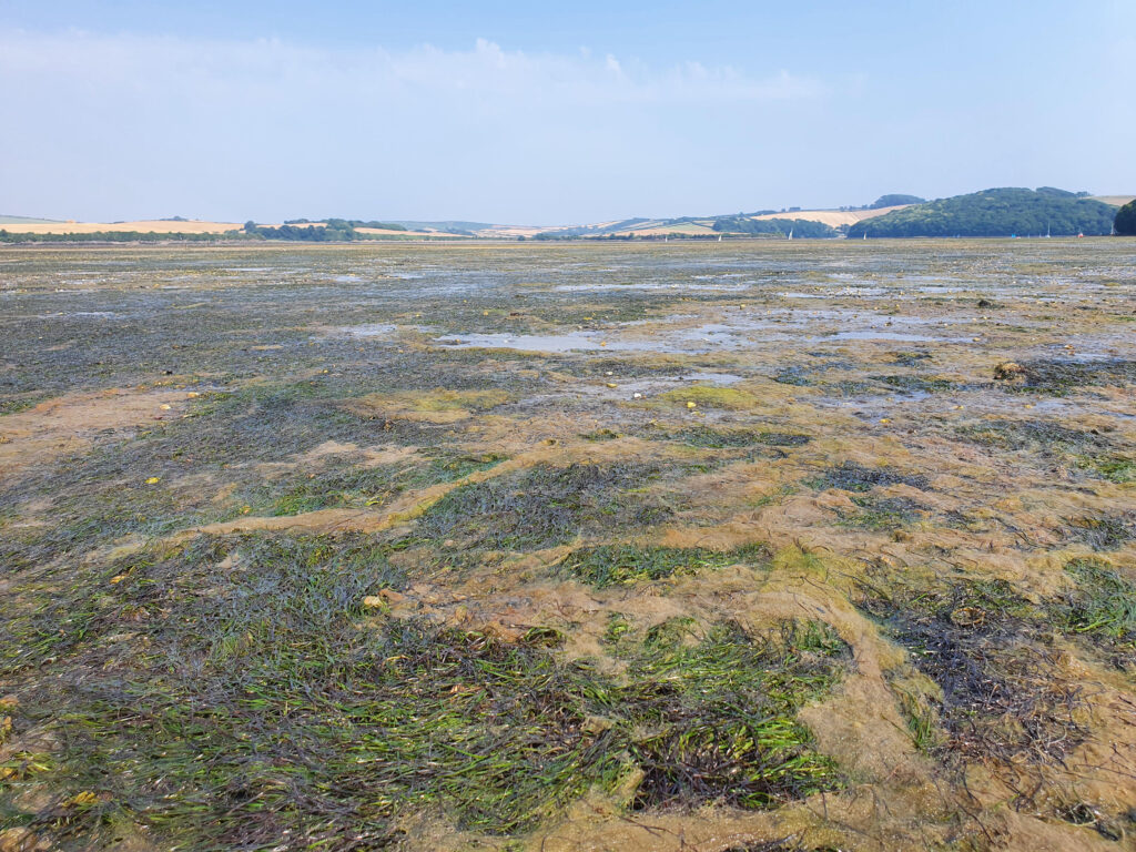
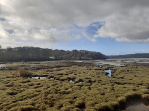
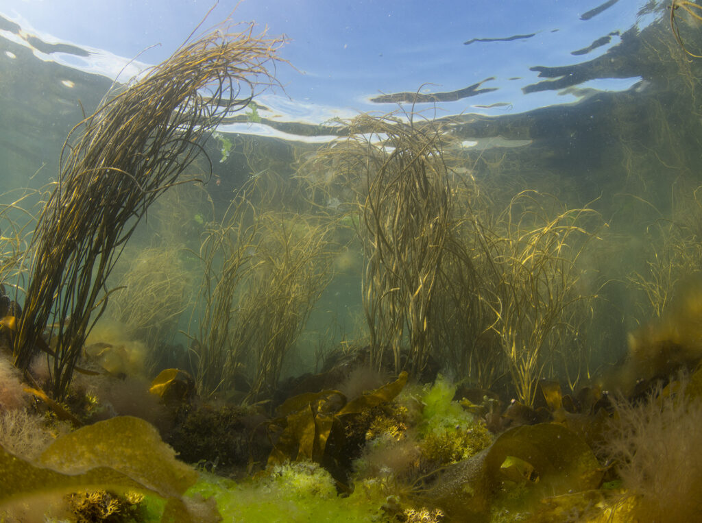
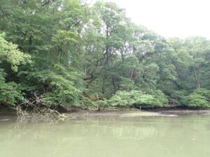
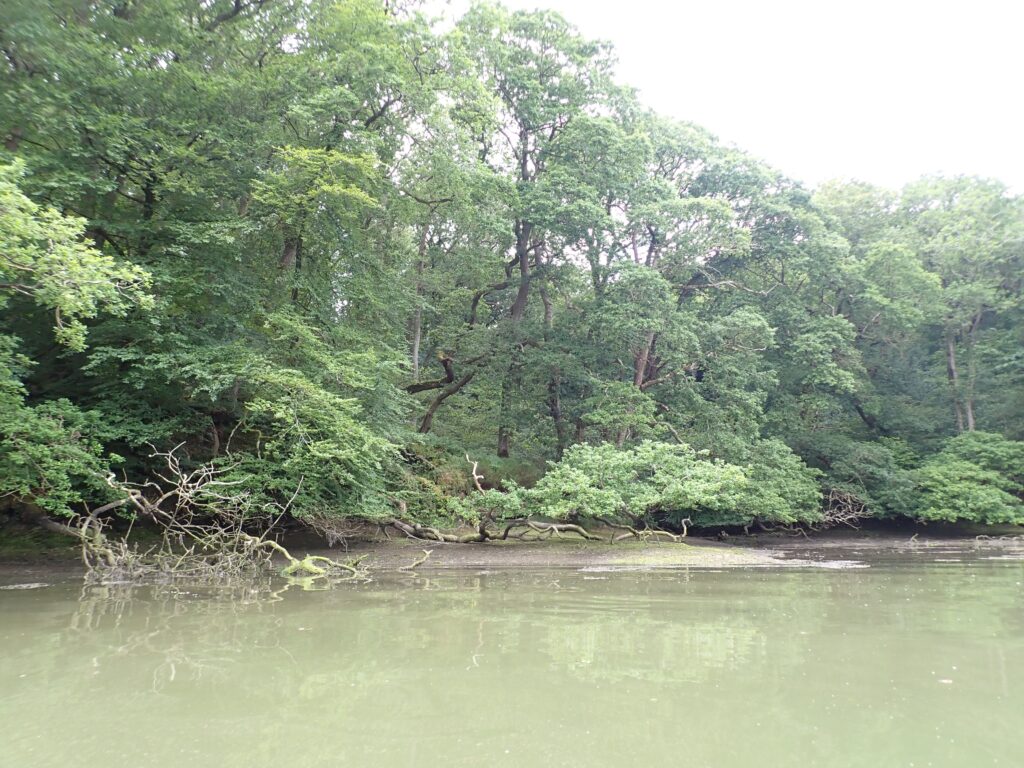
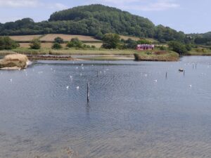
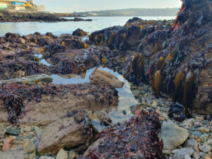
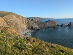
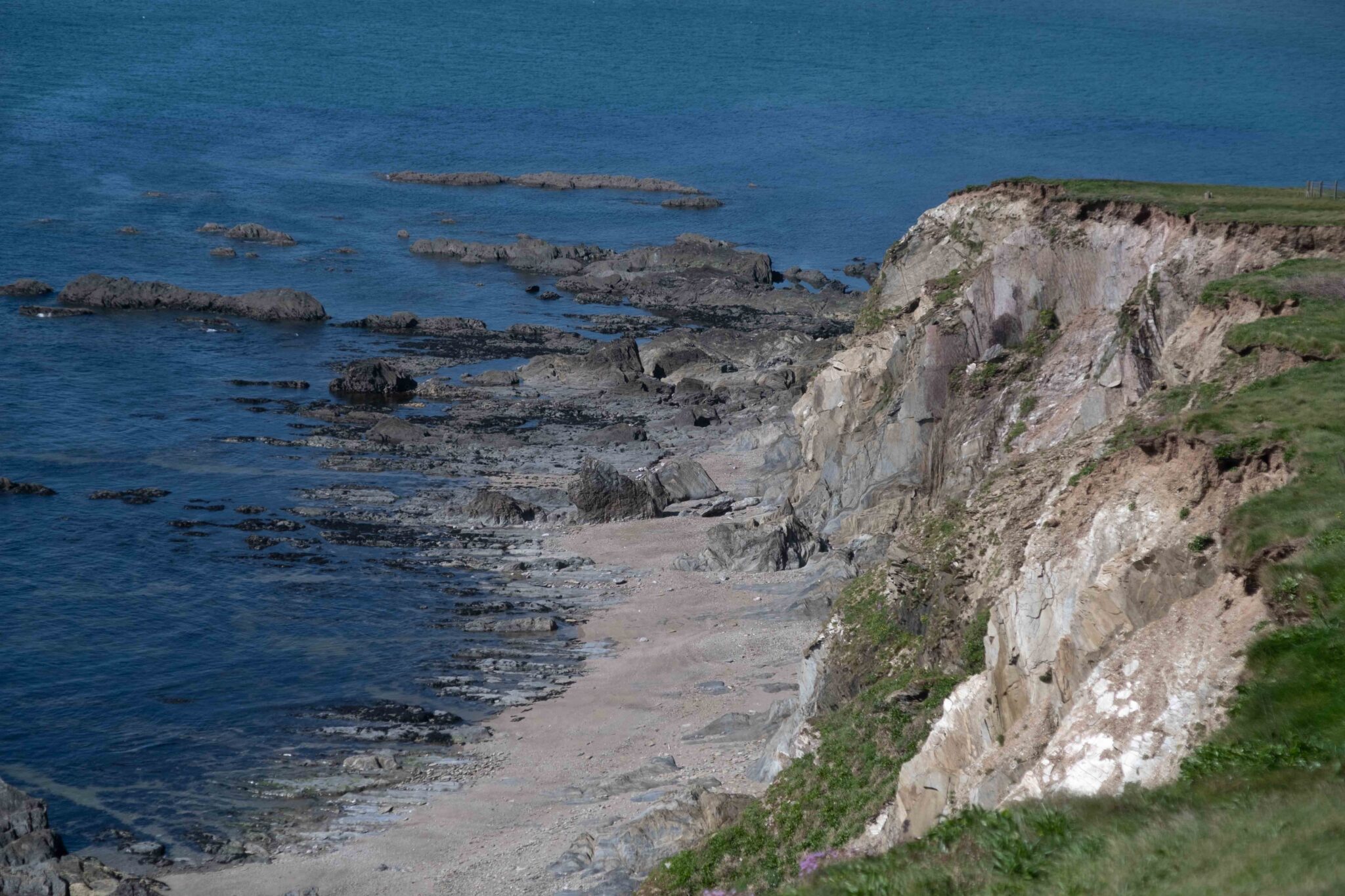
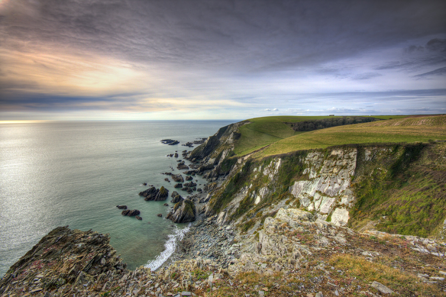
What wildlife-rich looks like:

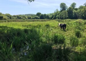
Need to add non-intertidal.

A mosaic of habitats periodically exposed and covered by the tides as they rise and fall. These habitats provide a refuge for juvenile fish and are rich in invertebrates such as crabs, worms, mussels and cockles, which are a critical food source for wading birds. 

Focus Species:

Intertidal: Grey seal, estuarine birds, migratory fish and spiny and short-snouted seahorses, spiny cockle, native oysters, yellow striped bear spider. (More to be added).

Cliffs and maritime grasslands: coastal invertebrates and plants (see detail in the Focus Species drop-down below).   

UK significance:

UK priority habitat: Blue mussel beds on sediment, coastal grazing marsh, coastal saltmarsh, coastal sand dunes, coastal vegetated shingle, intertidal mudflats, maritime cliff and slopes, reedbeds, sabellaria alveolata reefs, saline lagoons, seagrass beds.

Statutory irreplaceable habitat: Coastal sand dunes, spartina saltmarsh swards.

1. About

Devon’s two coastlines support an incredible variety of wildlife habitats, all united by their proximity to the sea and its salty influence. These habitats include towering sea cliffs topped by flower-rich coastal grasslands and heaths; intertidal rocky shores and sea caves; coastal reefs created by mussels, oysters and worms; and shingle vegetated beaches.

Devon has 13 estuaries that have evolved in the low-lying areas where rivers meet the sea. Here, softer sediments give rise to mudflats, saltmarshes and seagrass beds. These habitats are rich in invertebrates and support internationally important numbers of wintering birds as well as rare sea horses. Trees growing on the edge of our estuaries create what are now called temperate mangrove forests and that provide habitat for fish and rare mosses and fungi.

Beyond their ecological value, these habitats have many other benefits. They offer significant opportunities for recreation, support fisheries, help protect the coast, help control pollution and play a vital role in the capture and storage of carbon.

Groups below to be redesigned on the page and potentially some grouped together.

Mammals: Harbour seals and grey seals

Wintering estuarine birds: Bar-tailed godwit – occur mainly on the Exe Curlew – Avocet – key wintering populations are in the Exe and Tamar but they are spreading into East Devon including the Otter. Dunlin – occur in nationally important numbers on the Exe estuary as well as on the Axe, Taw-Torridge, Kingsbridge and at Slapton Sands. Wigeon – Mostly on the Exe estuary but also Taw/Torridge and Kingsbridge estuaries Red breasted merganser – Exe and Teign estuaries Oystercatcher – Exe and Taw/Torridge estuaries (as well as breeding birds on Lundy, Exe, Taw-Torridge, Otter and the Axe) Little ringed plover – have bred in Devon since 2002 in very small numbers, usually on wetlands next to Devon’s larger estuaries. Snipe – widespread on coastal marshes and wet fields

Nesting seabirds:

Osprey.……add text…..

Fish: Seahorses and migratory species such as sturgeon

Moths: Sea spurge tortix (Acroclita subsequana) a micromoth found at Strete Gate Beach in Slapton.  See north and south coast invertebrate group

Spiders: Yellow-striped bear spider (Taw estuary at Yelland) and Prawle spiders

Grasshoppers and crickets: Scaly cricket (Branscombe shingle beach) 

Molluscs: Spiny cockle, Acanthocardia aculeata (all estuaries but particularly Salcombe), native oyster, false flat-backed millipede (Anthogona britannica

Sea anemones and stalked jellyfish: Stalked jellyfish and glaucous pimplet

Plants: Triangular club-rush (Upper Tamar estuary mudflats), Borrer’s saltmarsh grass (Exe Estuary grazing marsh, salt marsh and mudflats) divided sedge (Lower Otter), dwarf spike rush (Avon at Aveton Gifford) add others

Bryophytes and fungi: Species found in woody mangroves.

Marine Management Organisation (MMO) Marine Plans:

The MMO marine plans place sustainable development at the heart of decision-making, helping to reduce legal risks and balance social, economic and environmental considerations. For the Devon Local Nature Recovery Strategy, the South West and South Inshore Marine Plans are relevant. All public authorities must comply with these plans, regardless of their proximity to the coast. There is detailed guidance on the Marine planning in England page on the GOV.UK website.

Environment Agency Shoreline Management Plans (SMPs):

SMPs are long-term strategies developed by the Environment Agency and coastal groups to manage the risks of coastal flooding and erosion along England’s coastline. SMPs help guide decisions, such as the adaptation of flood defences, how to protect and restore natural habitats such as saltmarshes and mudflats and how to plan for climate change impacts, including sea level rise.

Devon and Severn Inshore Fisheries and Conservation Authority (IFCA):

The Devon and Severn IFCA is responsible for managing and conserving the marine environment and inshore fisheries across a large district that includes both the north and south coasts of Devon. The IFCA regulates both commercial and recreational fishing through byelaws and permit systems to ensure fish stocks are harvested sustainably.

Devon Estuary Partnerships:

Several estuary partnerships exist in Devon. Examples, such as the Exe Estuary Management Partnership, bring together local authorities, conservation groups, landowners, businesses and community members to manage and protect estuarine environments. 

For more information see Find out more below.

This is very draft  – add most up to date information through discussion with NE and DBRC after the Consultation. 
 
Designations
SPA
Exe Estuary (including Dawlish Warren), Tamar Estuaries Complex, East Devon Heaths
SAC
Blackstone Point; Braunton Burrows; Dawlish Warren; Lundy Island; Lyme Bay and Torbay; Sidmouth to West Bay; South Devon Shore Dock
RAMSAR
Exe Estuary
 
Sites of Special Scientific Interest (SSSIs):
Estuarine Sites
Exe Estuary; Tamar-Tavy Estuary; Taw-Torridge Estuary; Kingsbridge Estuary (Salcombe–Kingsbridge); Otter Estuary; Teign Estuary.
Coastal Sites
Axmouth to Lyme Regis Undercliffs; Babbacombe Cliffs; Barricane Beach; Beer Quarry Caves; Berry Head to Sharkham Point; Bolt Head to Bolt Tail; Braunton Burrows; Dawlish Warren; Lundy Island; Prawle Point to Start Point; Slapton Ley; Teignmouth to Dawlish Cliffs; Wembury Point; Morte Point; Hartland Point to Tintagel (partly in Cornwall).
 
Total: 116 sites and 2,710 hectares

Coastal saltmarsh: 25 sites and 116 hectares
Intertidal mudflats: 16 sites and 673 hectares
Reedbeds: 14 sites and 68 hectares
Coastal floodplain and grazing marsh: 17 sites and 681 hectares
Sabellaria alveolate reef: 4 sites and 2 hectares
Coastal sand dune: 3 sites and 44 hectares
Coastal vegetated shingle: 1 site and 1 hectare
Maritime cliff and slope: 36 sites and 1,125 hectares

Key pressures and opportunities

Pollutants and contaminants from agriculture, industry and urban areas are carried by run-off and rivers into coastal environments where they’re trapped and stored in the sediments of habitats, such as mudflats and saltmarshes. Plants and microorganisms in these habitats absorb excess nutrients, helping to prevent harmful algal blooms. However, although trapping sediments improves water quality, pollutants can be released back into estuarine environments. Nutrient enrichment can cause phytoplankton blooms that can harm seagrass beds. High pollution levels reduce light penetration and increase fouling algae.

Coastal vegetation, particularly eelgrass, can also accumulate harmful substances such as heavy metals, which can reduce plant viability, especially in nutrient-poor conditions. Several of the estuaries in Devon (notably the Salcombe-Kingsbridge and Yealm) show signs of excessive levels of nutrients (otherwise known as eutrophication).

During periods of heavy rainfall, combined sewage overflows discharge untreated or partially treated sewage directly into rivers and coastal waters. These discharges can introduce pathogens, nutrients and organic matter into estuarine environments, worsening eutrophication and posing risks to both human health and marine life.

Blue mussel beds and native oyster reefs are natural filtration systems. A single oyster can filter up to 200 litres of water per day, and mussels can filter similar volumes depending on conditions. This process clears the water, improving light penetration and reducing turbidity.

Coastal habitats are increasingly vulnerable to the impacts of climate change, including sea level rise, increased storminess, warming sea temperatures and shifting weather patterns. These changes can lead to habitat degradation, erosion and species loss across a wide range of coastal ecosystems, such as estuaries and saltmarshes, sand dunes, seagrass beds and coastal mangroves.

Rising sea levels and more frequent storm surges can inundate low-lying areas, causing vegetation in habitats such as saltmarshes, dune slacks and reedbeds to die back. Warmer sea temperatures and changes to salinity can disrupt ecological balances, affecting species composition, productivity and resilience. Reduced sunlight penetration, often due to increased turbidity or cloud cover, causes further stress to photosynthetic organisms such as seagrasses and seaweeds.

Despite these pressures, coastal habitats play a vital role in climate regulation through blue carbon storage. As the plants in them grow, ecosystems such as saltmarshes, seagrass meadows, mudflats and mangroves capture atmospheric carbon dioxide and trap it in their sediments. The sediments can store carbon for centuries, or even millennia if left undisturbed, often at rates far exceeding those of terrestrial forests.

In addition to their capacity for carbon storage, many coastal habitats offer natural protection against climate-related hazards. Saltmarshes, sand dunes and vegetated shingle beaches act as natural buffers, absorbing wave energy, reducing coastal erosion and helping to mitigate flood risks. By trapping sediments and stabilising shorelines, these habitats increase coastal resilience and support biodiversity.

Swinging moorings and anchoring by recreational and commercial vessels can seriously disturb coastal habitats, particularly in areas with sensitive seabed vegetation such as seagrass beds. Traditional swinging moorings use a heavy anchor block and chain. As boats shift with wind and tide, the anchor drags across the seabed, scouring it and creating bare patches, preventing regrowth and exposing seagrass beds to disease.

Activities such as BBQs and fires, dog walking, litter and trampling can damage sensitive areas. Wildlife can adapt to predictable human activities but to ensure its long-term health, human interaction with wildlife must be balanced. Therefore, it’s important to recognise when human presence becomes too disruptive and manage it to sustainable levels. Wildlife needs time and safe spaces to rest, breed and feed.

Crab tiling and bait digging, primarily for lugworms and ragworms, disrupts sediment structure and can impact the broader ecosystem. Hand-gathering of shellfish (such as cockles) can also exert pressure on intertidal zones, particularly when done intensively or without regulation. These activities may impact food availability for wading birds and other species that depend on healthy invertebrate communities.

Dredging can disturb the seabed, resuspend fine sediments and smother sensitive habitats such as seagrass beds, saltmarshes and shellfish reefs. In estuaries, dredging can interfere with natural sediment processes.

To be added following further discussion during consultation

Land use changes create significant pressure on estuarine habitats. The construction of sea defences and housing developments can cause habitat loss and coastal squeeze. These structures prevent habitats from migrating inland in response to sea level rise and other coastal processes, leading to reduced ecological function. For example, extensive development and sea defences in and around Exmouth have left little to no room for habitat to renew or retreat inland. 

However, there are also areas that have been identified for managed realignment or regulated tidal exchange (RTE), offering opportunities to restore natural processes and allow habitats to expand inland.

Artificial lighting in marine environments, often from coastal infrastructure, ports, marinas and vessels, can significantly disrupt natural light cycles and pose a growing pressure on coastal and estuarine ecosystems. The light pollution can alter the behaviour of marine species, including fish, invertebrates and seabirds, by interfering with navigation, foraging and reproductive patterns.

Invasive species and disease present growing threats to coastal and estuarine ecosystems.

Invasive non-native species such as Spartina anglica (a hybrid cordgrass) and Sargassum muticum (Japanese wireweed) are increasingly colonising intertidal zones, particularly mudflats and saltmarshes. These species often outcompete native vegetation, altering sediment dynamics, reducing biodiversity and reshaping the physical structure of coastal habitats. In estuarine areas, dense stands of Spartina can trap sediment and transform open mudflats into monocultures, displacing native flora and fauna.

Originating from the Pacific coast of Asia, Pacific oysters (Magallana gigas) are rapidly colonising our shores. They often live in estuarine environments and form stubborn reefs that are hard to remove. Their proliferation in estuaries, such as the Exe Estuary, raises concerns about their long-term ecological impact.

In the 1930s, a wasting disease caused large areas of seagrass in the UK to die back. The fungus and slime mould which colonised the weakened seagrass have recently reappeared in seagrass beds around the Isles of Scilly.

See Invasives and disease for more information.

Devon’s coastlines offer valuable opportunities to restore intertidal habitats, such as saltmarshes, seagrass beds and native oyster reefs, through targeted environmental initiatives. Notable examples of successful restoration include the Lower Otter Restoration Project in East Devon. However, opportunities are more limited in areas such as the Exe Estuary due to urban development and the coastal defences that protect the railway line.

The restoration of native oyster beds would particularly benefit sustainable aquaculture and eco-tourism.

Devon’s coastline is not only ecologically rich but is also highly cherished by local communities, offering a significant opportunity for community-led coastal conservation and restoration. From beach cleans and citizen science initiatives to local heritage groups and marine conservation volunteering, there’s a growing wave of public interest in safeguarding and enhancing the region’s coastal landscapes.

2. What we need to do and where

Priority

Better (wildlife-rich) intertidal and terrestrial habitats along both Devon’s coasts with dynamic natural coastal processes and resilient populations of Focus Species.

See Find out more below for any relevant national and local targets.

Actions

Manage and restore a mosaic of connected inter-tidal and terrestrial wildlife-rich habitats and natural processes, particularly for Focus Species.

Improve water quality in coastal areas

  • Restrict hull cleaning to designated facilities that have appropriate waste management.
  • Improve how waste is managed in harbours.
  • See Watercourse corridors for other actions.

Reduce recreational, commercial and navigation disturbance

  • Design and manage access (including paths, fences, signs and viewing areas) to prevent harm to sensitive wildlife areas including bird feeding and nesting areas (all coastal habitats including cliffs). 
  • Use regulations to control the timing and type of water-based recreational activities allowed in bird-sensitive areas, such as restricting access to critical winter feeding areas and any breeding areas.
  • Create buffers and ‘no-go’ zones for coastal users (including swimmers) and watercraft in line with the Marine and Coastal Wildlife Code.  Publicise the Code at all coastal access points and the coast path near sensitive seal sites. 
  • All commercial boat operators, wildlife tour operators, adventure activity operators and other relevant operators and organisations using the coast to follow best practice under the WiSe Wildlife Safe Operator scheme.  
  • Discourage the use of barbecue fires using driftwood and other foraged materials.
  • Safe navigation in estuaries must consider the height of seagrass beds. Encourage vessels to routinely navigate in deeper waters, maintaining a speed that minimises wake and ensures that vessels remain level to prevent propeller wash from disturbing inter-tidal habitats.
  • Establish no-anchor zones and support seagrass-friendly mooring trials to minimise damage.
  • Explore the use of artificial habitat enhancements to quay walls to foster a more natural and diverse wildlife community along manmade quays and seawalls.
  • Protect seal haul-out sites from human disturbance. See Intertidal mammals.

Control invasive species

  • Remove, and eradicate where possible, invasive non-native species such as Pacific oysters and the leathery sea squirt.  See Invasives and disease.

Reduce light pollution and litter (will split into two sections – lighting and litter)

  • Minimise light pollution to protect coastal wildlife. Use downward-facing, low-intensity and motion-activated lighting where it’s essential, and avoid lighting sensitive habitats where possible.
  • Expand ghost gear retrieval programmes to prevent lost or discarded nets from harming marine life. 
  • Increase the number and visibility of bins at popular beaches and coastal paths.
  • Promote “leave no trace” principles among visitors and local communities.
  • Support projects such as Plastic Free North Devon, regular beach cleans and citizen science initiatives to monitor litter trends.
  • Work with local businesses to reduce single-use plastics and encourage sustainable alternatives.

Restore natural coastal dynamics and increase the area of intertidal habitats such as mudflats, saltmarsh, seagrass beds and organic reefs

  • Maintain, and restore where possible, natural coastal processes, hydrological regimes, degraded water tables and sediment supplies.  
  • Modify or remove hard coastal defences where appropriate to restore intertidal habitats. Use managed realignment approaches in accordance with the recommendations in the Shoreline Management Plan and building on the learning from projects such as saltmarsh restoration on the Dart and Yealm.
  • Manage dredging and silt deposition carefully and make sure that dredging activities do not disrupt sediment supply to intertidal habitats.
  • Include wildlife features in new sea defences.  

Where appropriate manage and create a wooded nature-rich riparian zone along estuaries

To discuss with the coastal steering group during Consultation

  • Create a mosaic of riparian habitats from the lower bank adjoining estuaries and into the adjacent landscape. This should include broadleaved tree species, scrub, open areas with non-woody plants and wetlands. Aim to provide dappled shade onto the watercourse and some open stretches between. Habitats should be as wide as possible and generally at least 10m from the bank top.
  • Establish coastal woodlands through natural or assisted regeneration.
  • Cut bankside vegetation from late September, on at least a two-year rotation, leaving one bank uncut each year.
  • Manage mature bankside trees, especially where they’re in a single line and have become prone to undermining and collapse.  
  • Leave trees, limbs and dead wood that’s fallen into the estuary as they’re important habitat, unless they’re a navigational hazard.
  • See Find out more below for guidance on riparian planting.

Manage and restore sand dunes and their microhabitats for wildlife, particularly for Focus Species

  • Lightly graze (rabbits, sheep) to maintain a complete range of successional stages (especially early stages) and microhabitats such as pools, damp slacks, mobile sand, bare ground and scattered scrub and trees.
  • Control invasive species, such as sea buckthorn.
  • Keep and protect transitions with adjacent habitats such as saltmarshes, woodlands or rivers.
  • Protect sensitive areas from recreational disturbance and periodically fence off areas of sand dunes to prevent damage by excessive disturbance or overuse.
  • Undertake restoration projects  – scrapes? Replanting?  Discuss with the coastal group

Add actions for sea cliffs and coastal grasslands / heaths etc

Survey and monitor all coastal habitats

  • Conduct regular and long-term surveys and monitoring to track changes in the condition and distribution of all coastal habitats over time and feed this data into management actions.  
  • Use advanced tools and technologies, such as remote sensing, drones and GIS, to improve the accuracy, efficiency and coverage of habitat assessments.
  • Quantify and evaluate the benefits of all coastal habitats (ecosystem services)

Increase awareness, engagement and responsible access

  • Engage local communities in coastal protection and restoration.
  • Establish no-anchor zones and install modified eco-friendly mooring systems.

Other relevant actions

More detailed actions are set out for the following Focus Species:

  • Mammals: Grey seals
  • Birds: Wintering estuarine birds, nesting seabirds.
  • Fish: Seahorses and migratory species such as sturgeon
  • Moths: Sea spurge tortix (Acroclita subsequana) a micromoth found at Strete Gate Beach in Slapton.  See north and south coast invertebrate group.
  • Spiders: Yellow-striped bear spider (Taw estuary at Yelland) and Prawle spiders
  • Grasshoppers and crickets: Scaly cricket (Branscombe shingle beach)
  • Molluscs: Spiny cockle, Acanthocardia aculeata (all estuaries but particularly Salcombe), native oyster, false flat-backed millipede (Anthogona britannica)
  • Other: Stalked jellyfish and glaucous pimplet
  • Plants: Triangular club-rush (Upper Tamar estuary mudflats), Borrer’s saltmarsh grass (Exe Estuary grazing marsh, salt marsh and mudflats) divided sedge (Lower Otter), dwarf spike rush (Avon at Aveton Gifford) add others
  • Bryophytes and fungi: Species found in woody mangroves.

Follow the links below to the relevant Focus Species pages as well as to relevant habitat and wider theme pages:

Where to focus action

Wildlife will benefit from these actions being implemented across coastal and intertidal habitats in Devon.  However actions are prioritised to the following High Opportunity Areas (in bold). See Mapping for the LNRS Viewer and information on how areas have been mapped.

All existing coastal habitats discussed above. Some habitats, including native oyster reefs and honeycomb worm reefs, are not mapped but are still a priority for action.

  • Saltmarsh and mudflat potential restoration areas
  • Seagrass potential restoration areas
  • Native oyster reefs potential restoration areas
  • Coastal Wildbelt    add further explanation when clear how best to do this….
  • Significant sea cliff bird colonies
  • Wintering estuarine birds (key estuaries)

3. Inspiration

To be finalised through Consultation

Case studies

There’s lots of great work going on across Devon’s coastlines. For example: 

South Efford Marsh

A tidal floodgate has been installed at the southern end of the reserve, flooding part of the site at each high tide. The land here had been saltmarsh for centuries until a stone and earth bank was constructed in the 18th century. Now, the returning saltwater is beginning to recreate a saltmarsh where sea-loving plants like marsh samphire, sea purslane, sea aster and common cordgrass are flourishing again. Local birdwatchers report that the higher water levels have resulted in an increased number of birds on the reserve.

Lower Otter Restoration Project (LORP)

The LORP restored 55 hectares of rare intertidal habitats, including saltmarsh and mudflats, enhancing biodiversity and supporting climate resilience. The project reconnected the River Otter to its floodplain by breaching embankments and creating over 6km of new creek channels, allowing natural tidal flow and flood management.

Where to visit

Always follow the Countryside Code and stick to footpaths and sites that are managed for public access. 

Lee Bay

Lee Bay’s rocky shores, nestled along north Devon’s dramatic coastline, offer a unique and picturesque destination for nature enthusiasts, photographers and families. The rugged shoreline is characterised by rocky outcrops, tidal pools and smooth pebbles interspersed with stretches of golden sand, creating a mosaic of habitats that reveal fascinating marine life at low tide.

Otter Estuary

The saltmarshes on the River Otter are significant ecological habitats in the River Otter Estuary Nature Reserve in east Devon. The area supports over 120 species of birds, including various migratory and resident species, making it a vital birdwatching site. The saltmarshes provide essential nursery grounds for fish such as sea bass and are home to a diverse range of salt-tolerant vegetation.

For information on visiting these and other sites see the Explore Devon website.

4. Find out more

Search this site:

clear
Beta